1
2
3
4
5
6
7
8

Laflora 1771
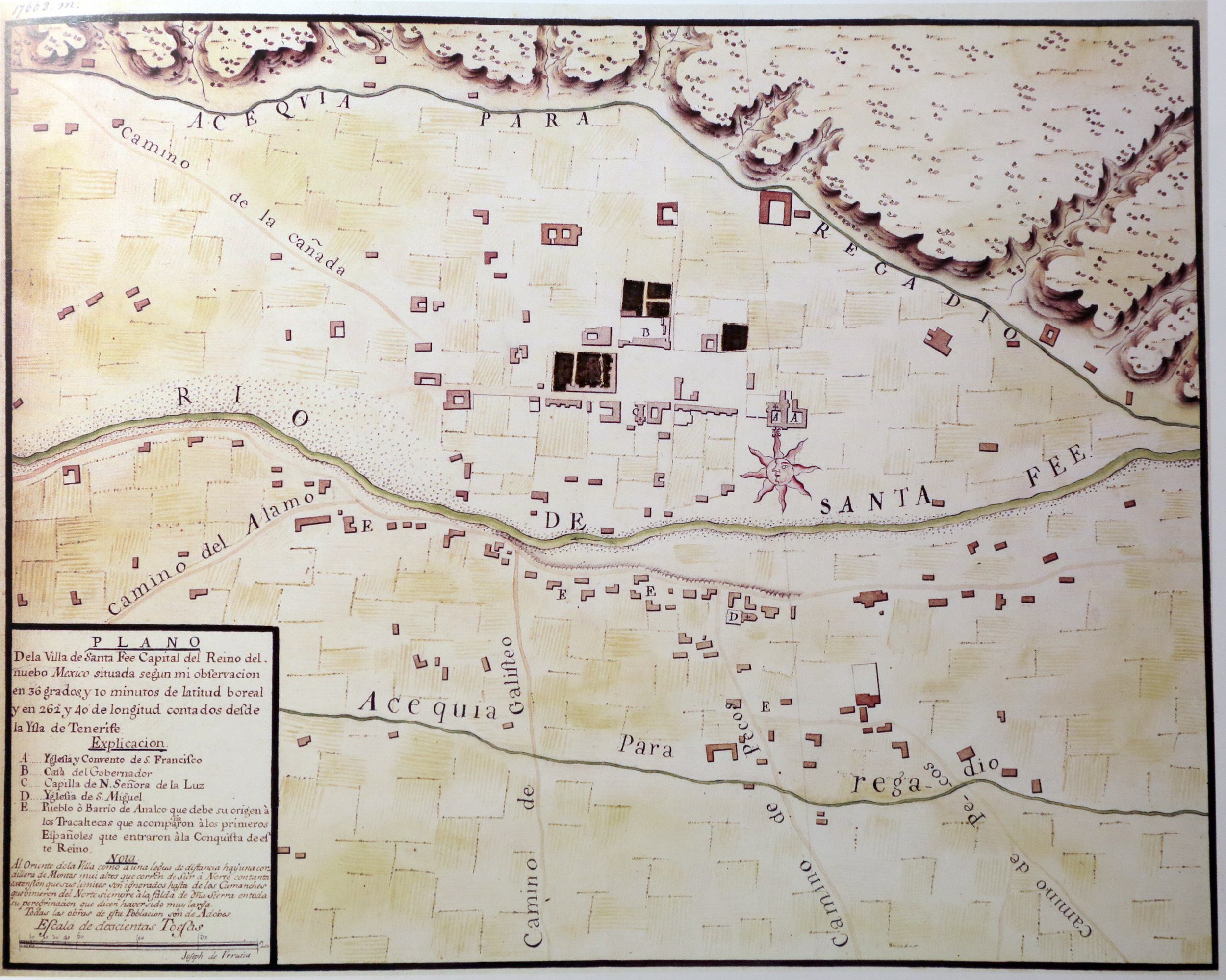
Map of Santa Fe, 1767
Map of Santa Fe, NM by the Spanish Royal Cartographer Joseph De Urrutia
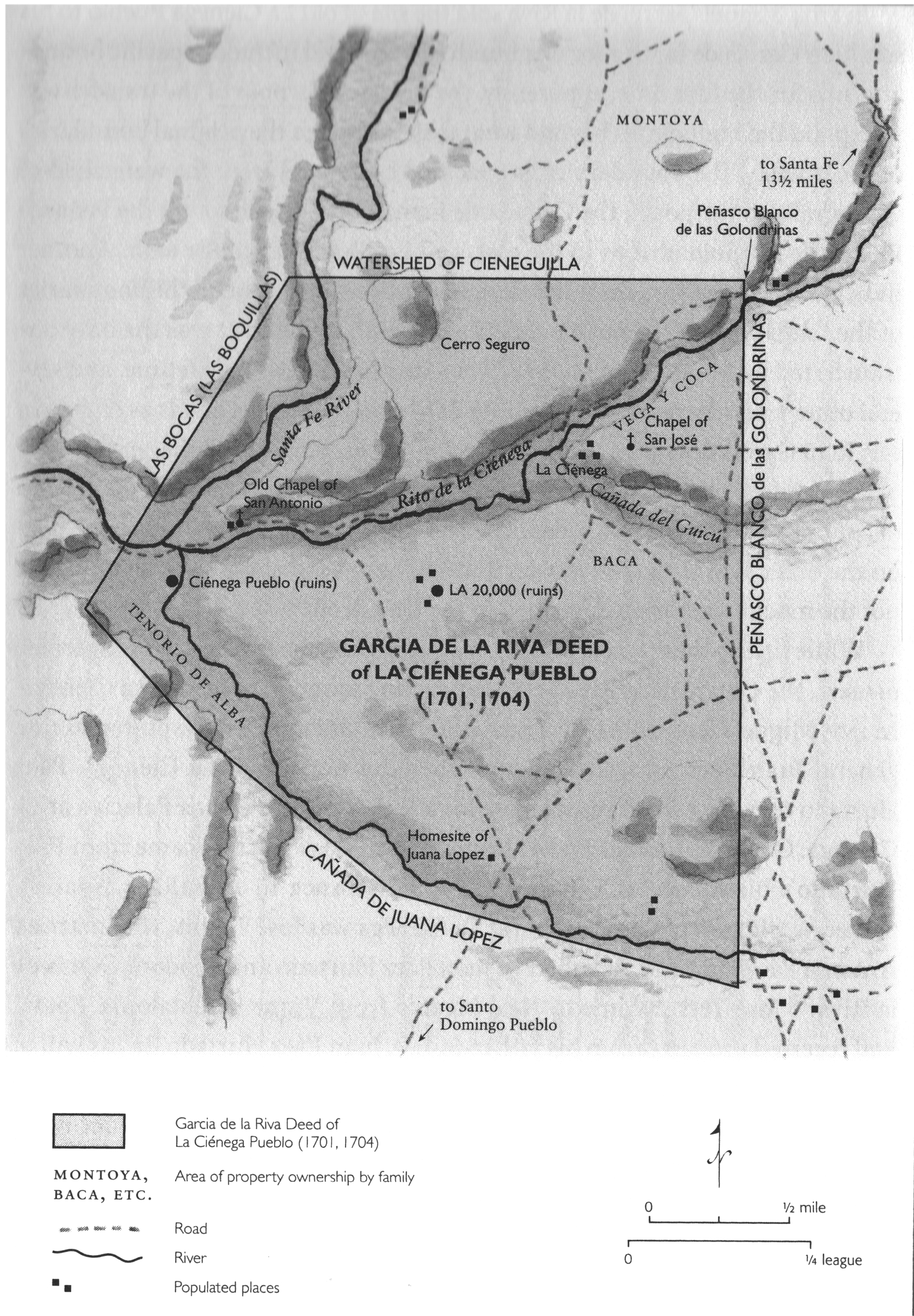
12 - La Ciénega Pueblo
Plan of García de la Riva property deed at La Cíenega, 1601-1704. Malcolm Ebright, Advocates of the Oppressed, Hispanos, Indians, Genízaros and Their Land in New Mexico, University of New Mexico Press, 2014: 121. Courtesy of Malcom Ebright. (Case 13)
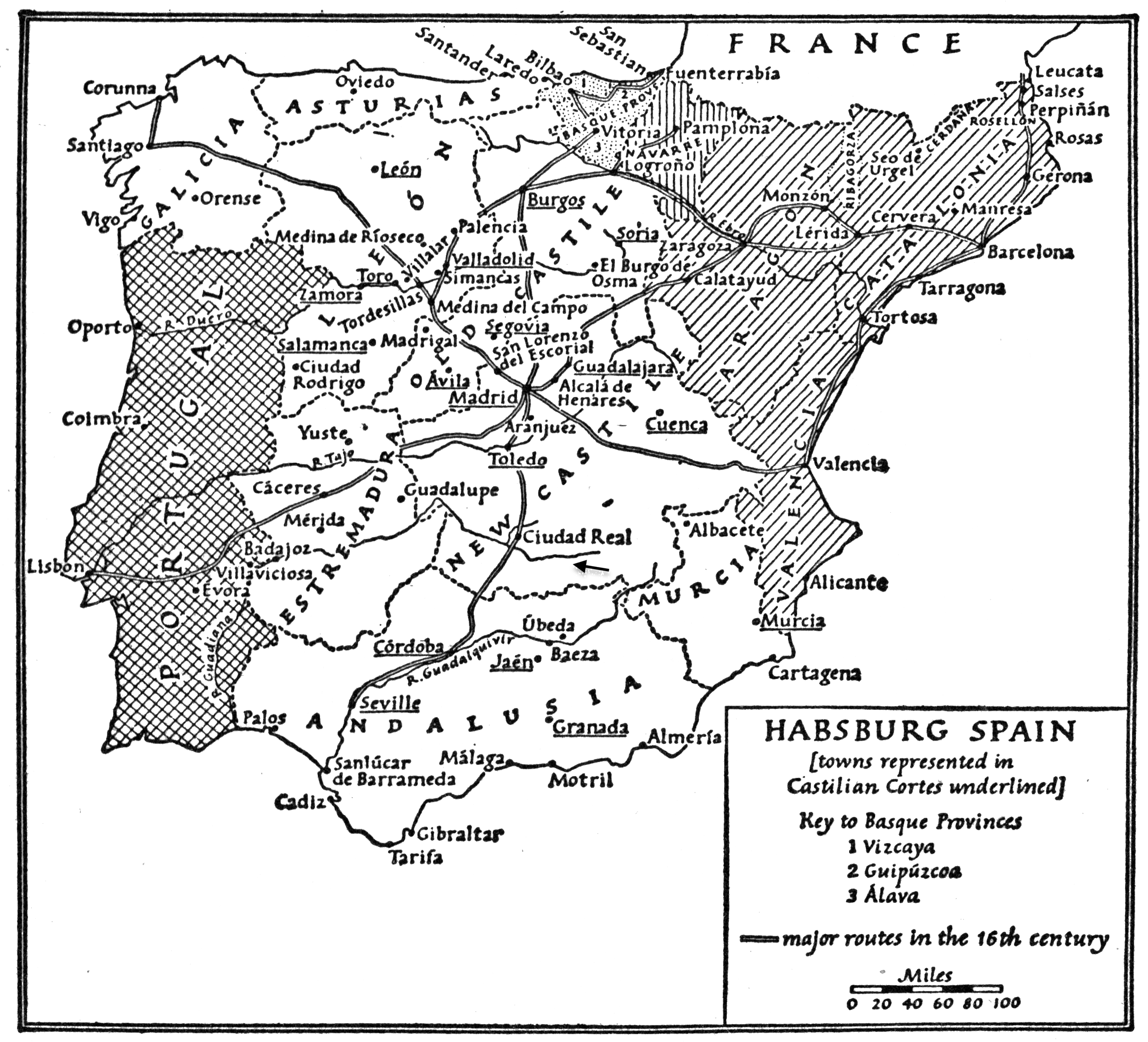
16 - Map of Spain 1720
Map of Hapsburg Spain showing the locations of Toledo and Cuidad Real. J. H. Elliott, Imperial Spain 1469-1716. New American Library, 1963:16. (Case 22)
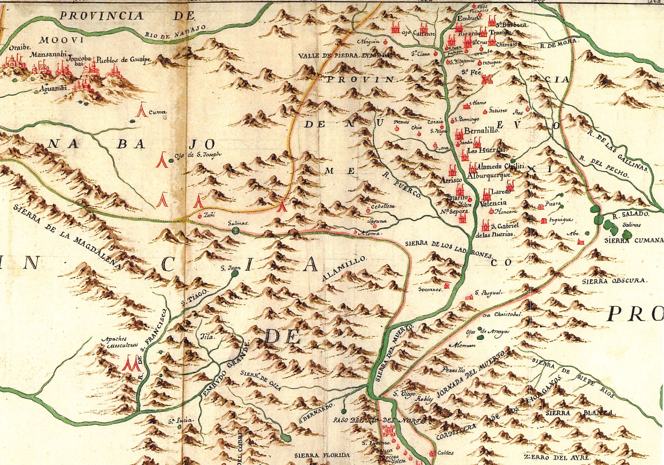
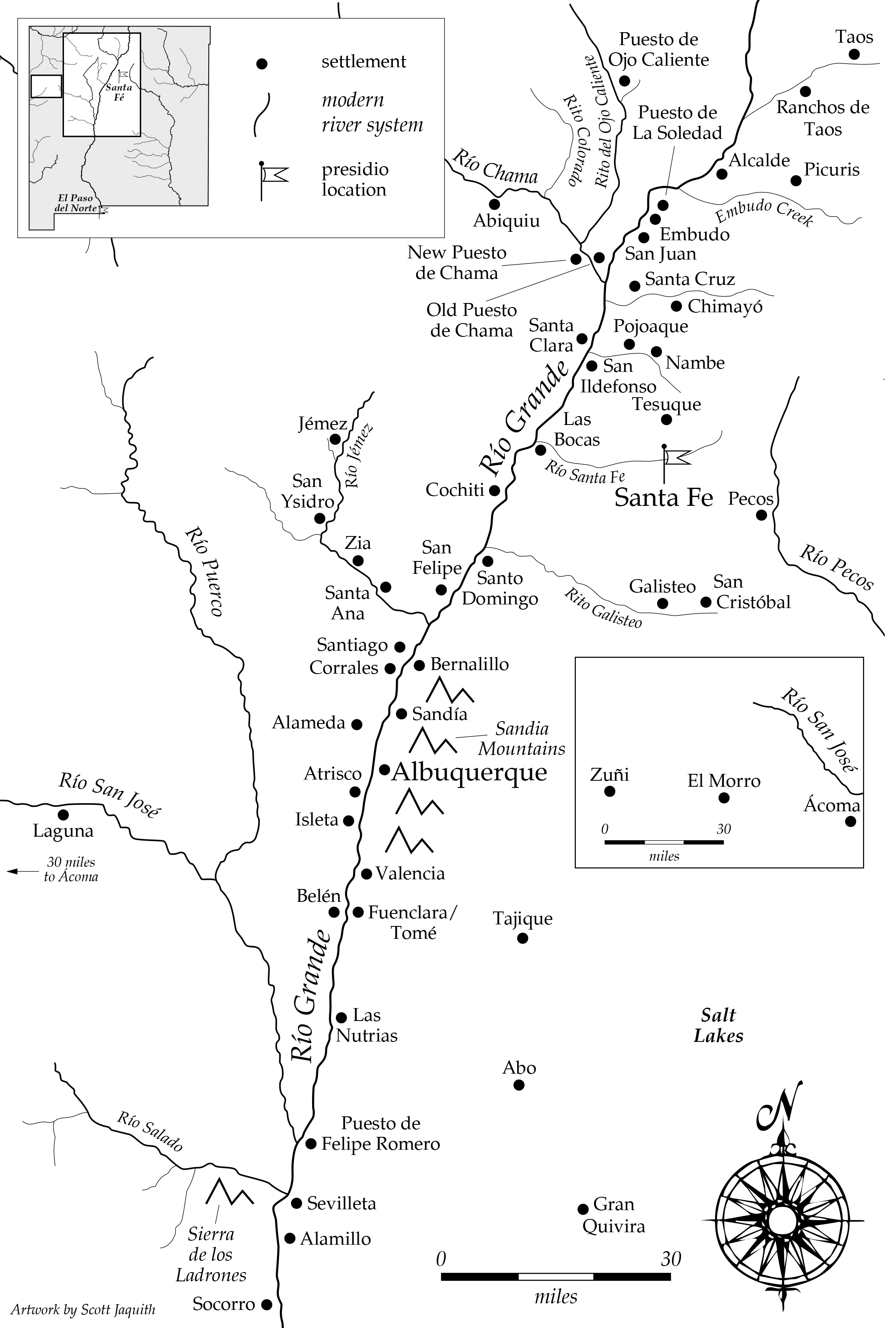
Nuevo Mexico Place Names - 1705-1770 (Map 1)
New Mexico in the Early and Mid- Eighteenth Century. Map drawn by Scott Jaquith.
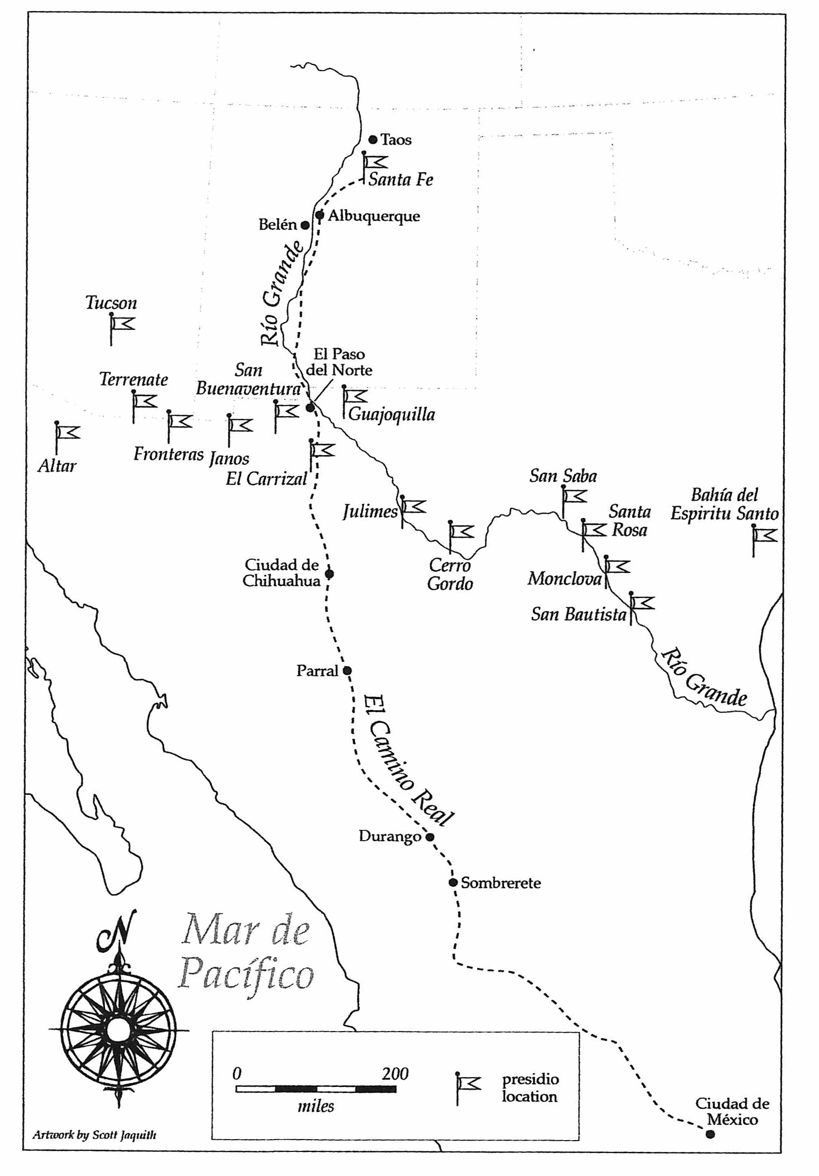
24 - Central New Spain (Map 2)
Central and Northern New Spain in the Eighteenth Century. Map drawn by Scott Jacquith
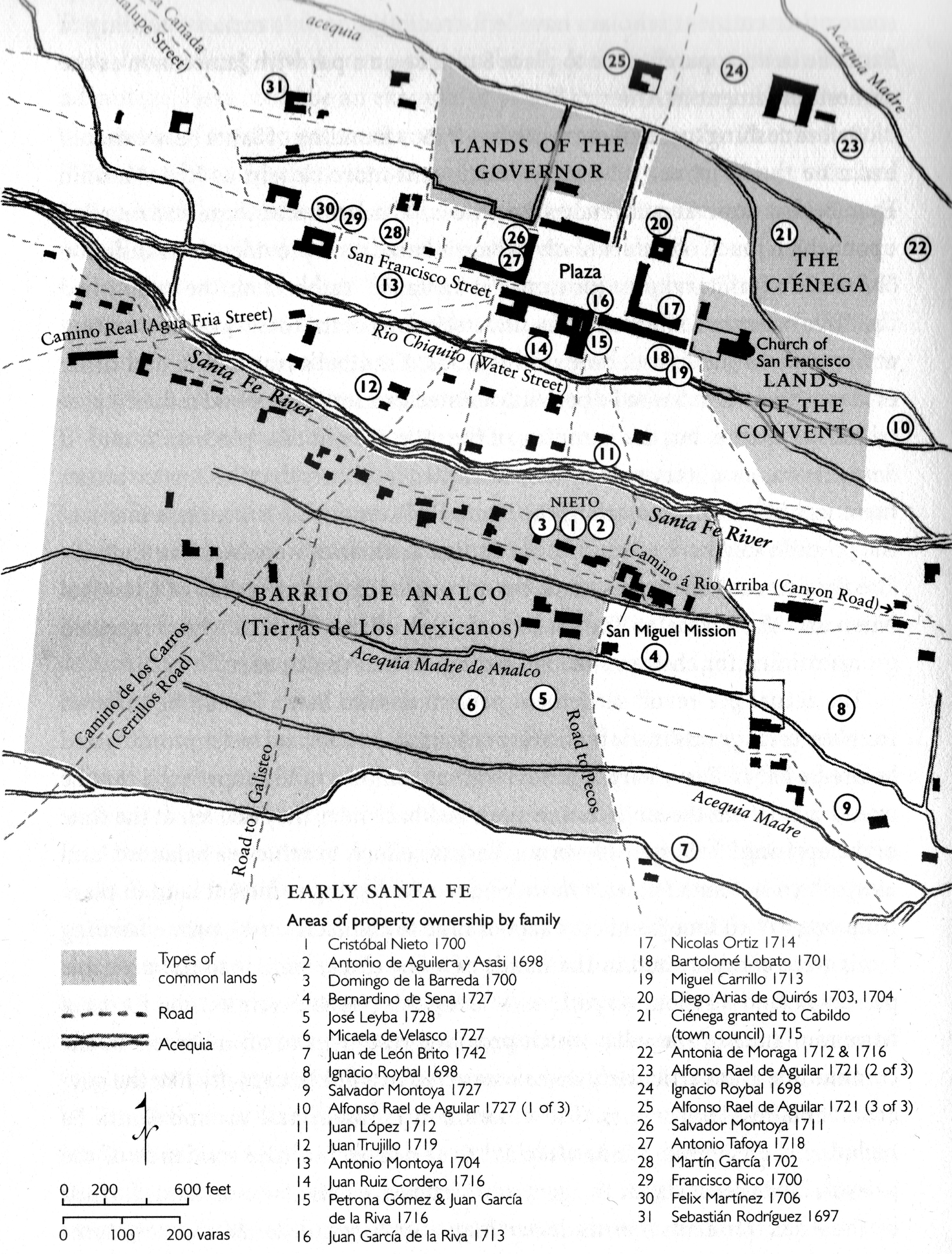
25 - Downtown Santa Fe 1730 (Map 3)
Early Santa Fe. Malcolm Ebright, Advocates for the Oppressed, 2014:56. Based on information from Malcom Ebright and Cordelia Thomas Snow. Courtesy of Malcolm Ebright.
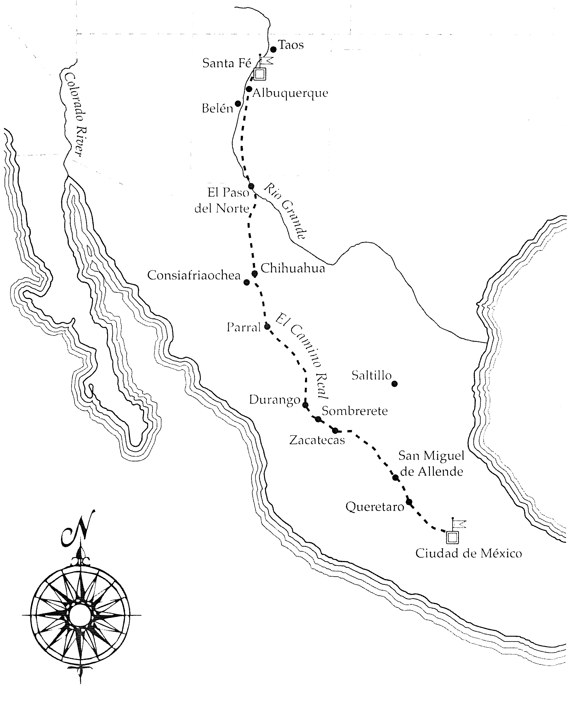
26 - Prisidios (Map 4)
Borderland Presidios in the Mid Eighteenth Century. Map drawn by Scott Jaquith.