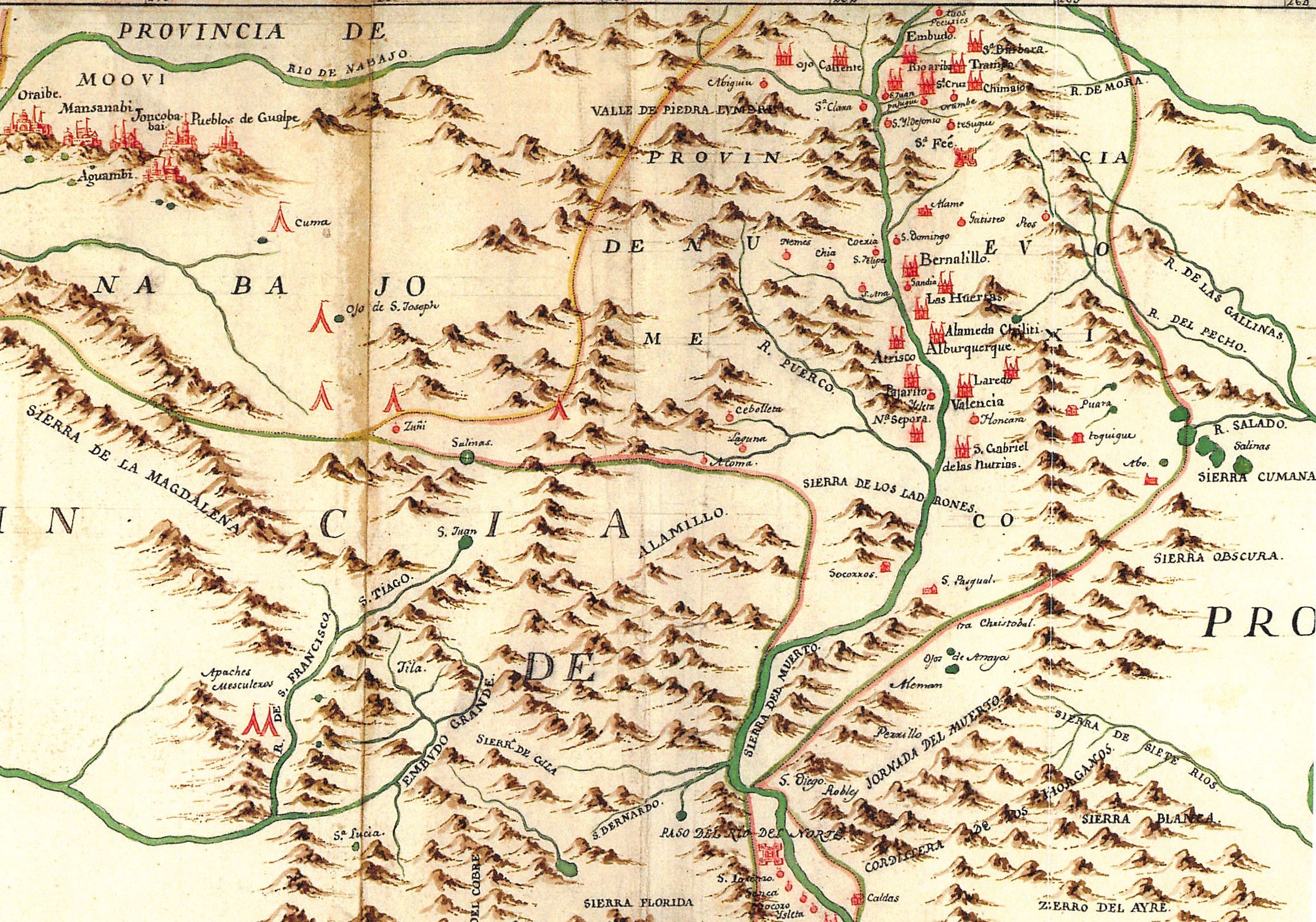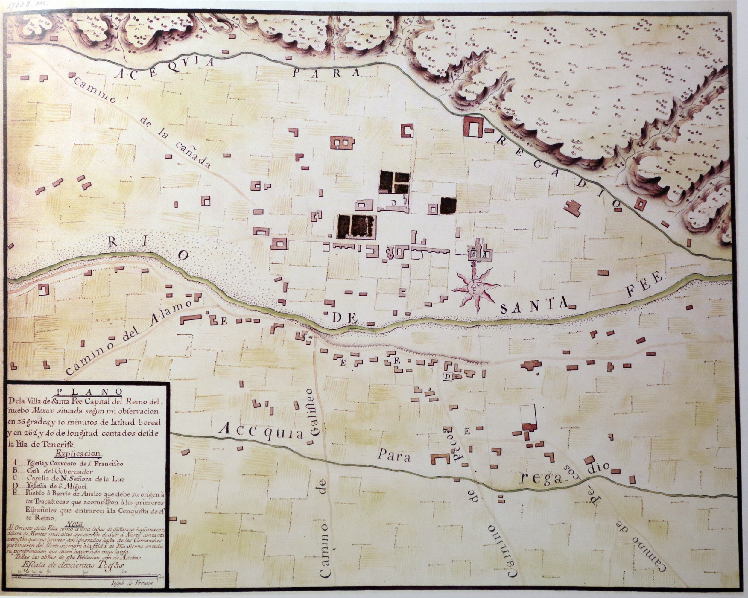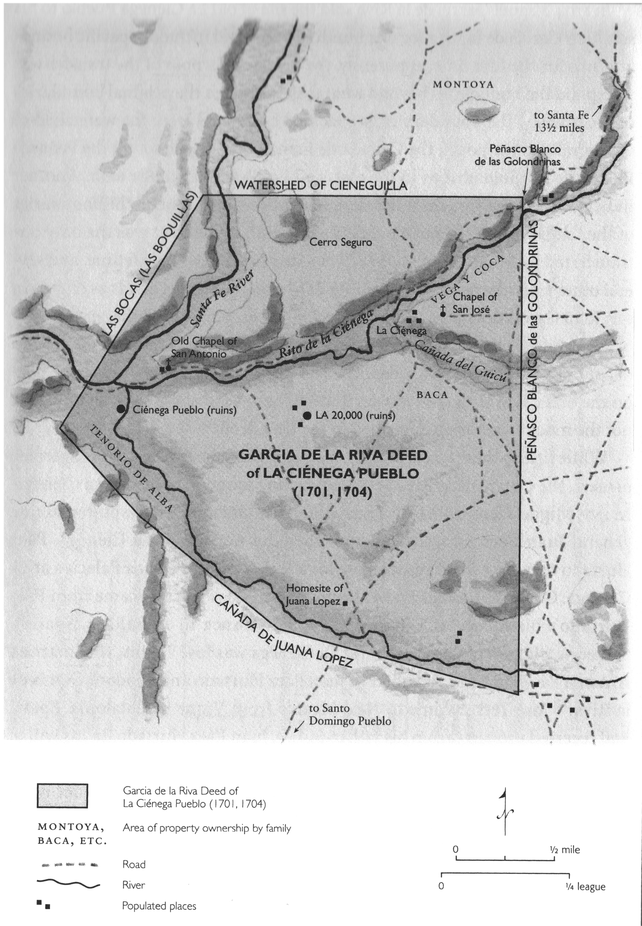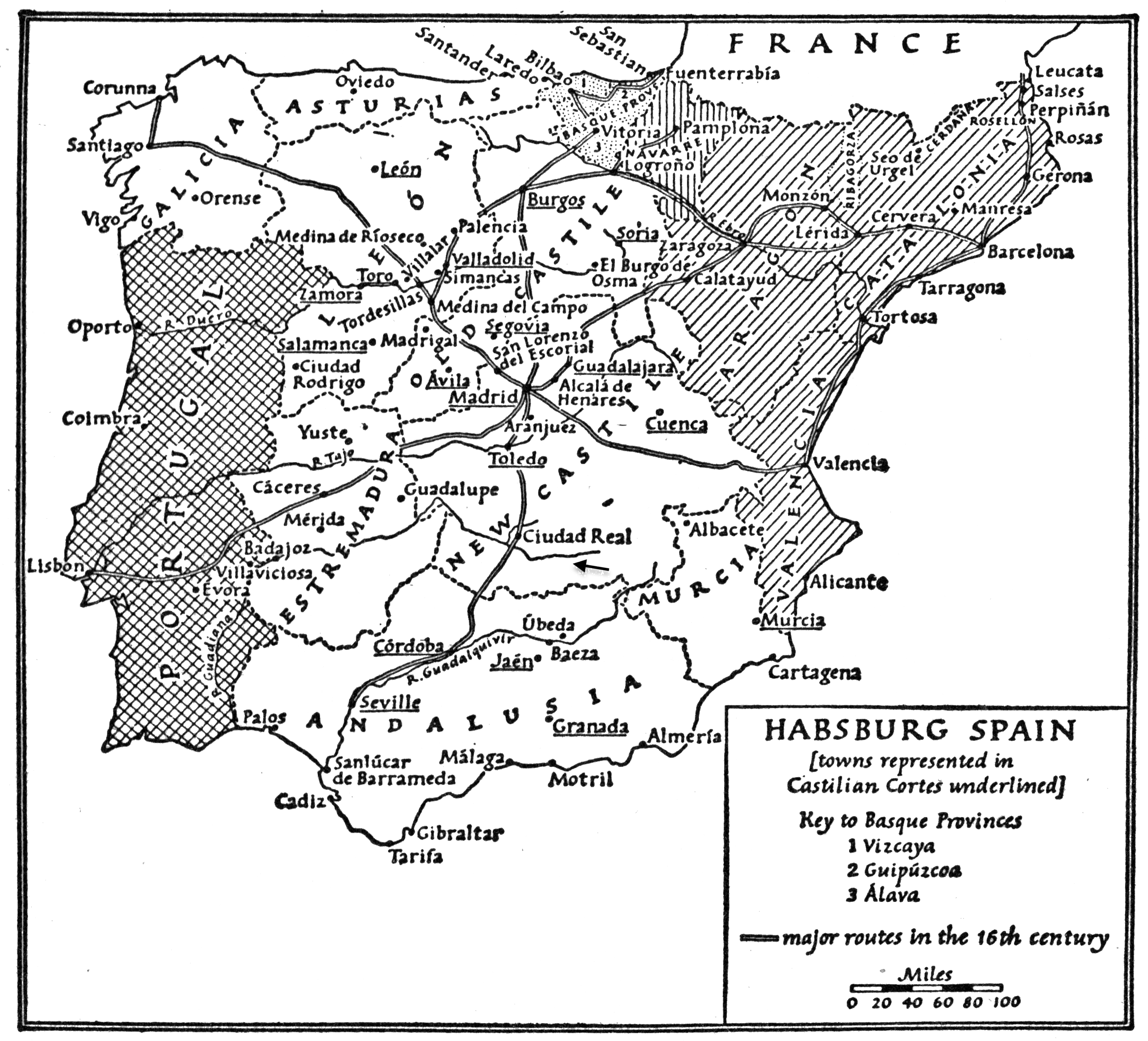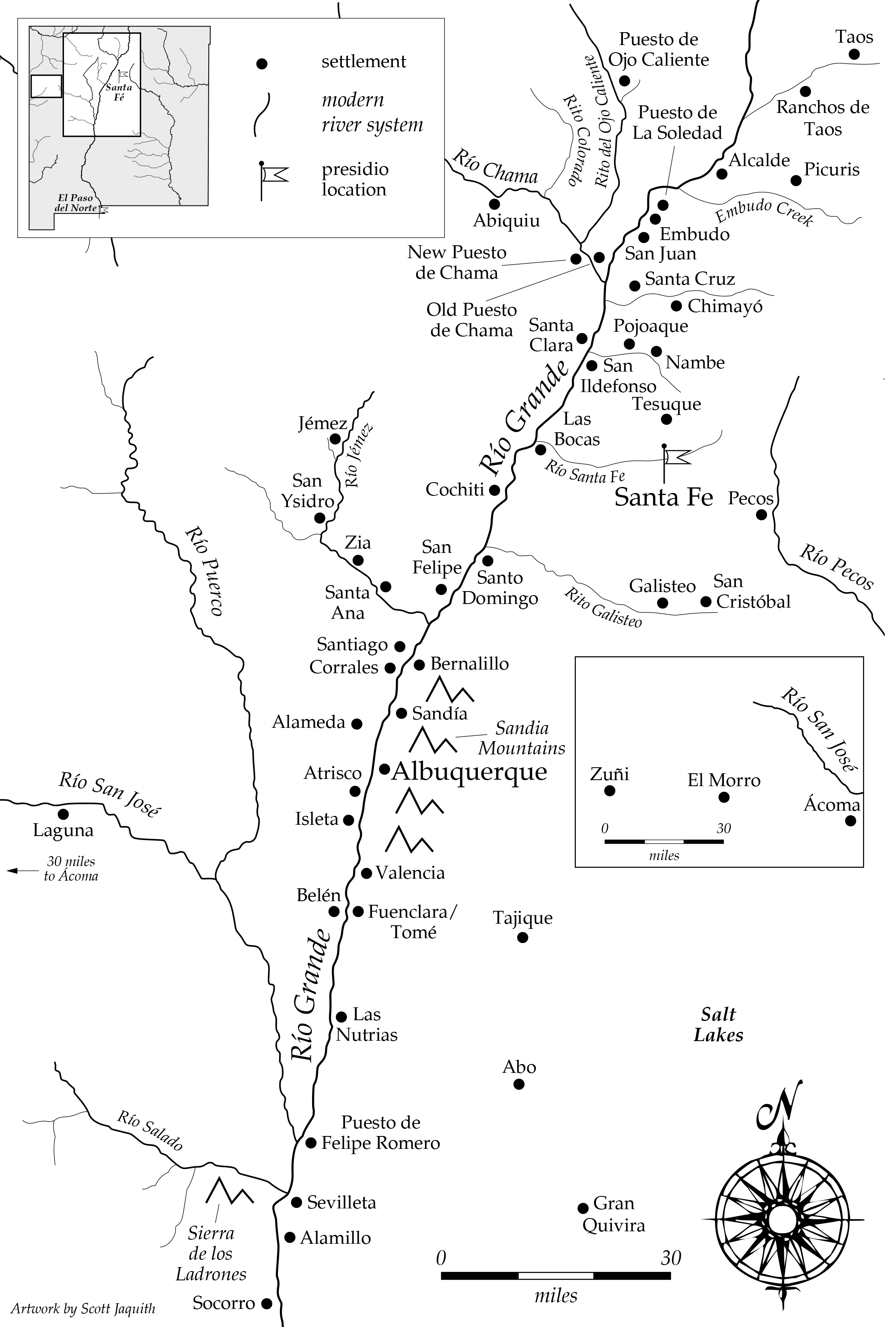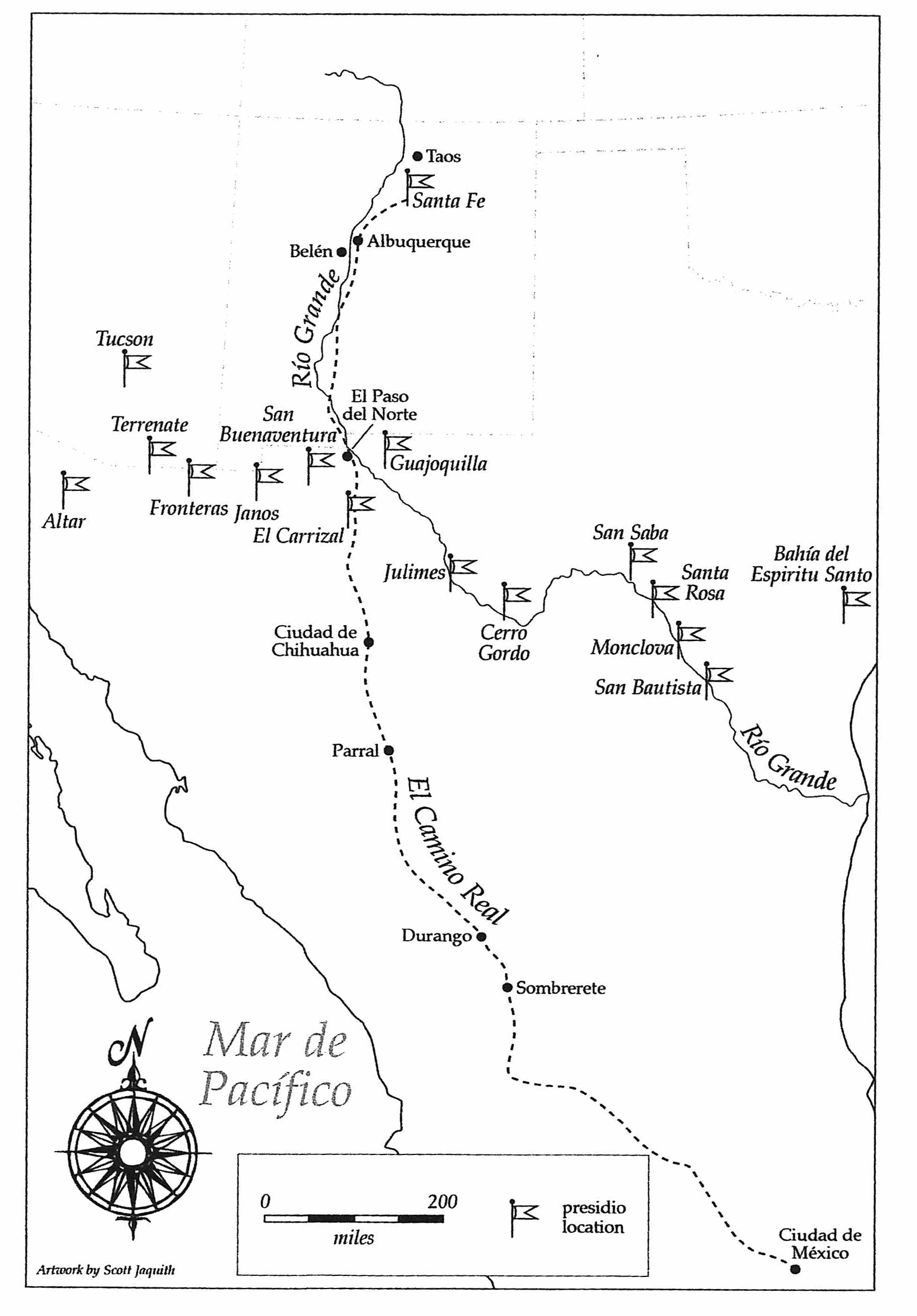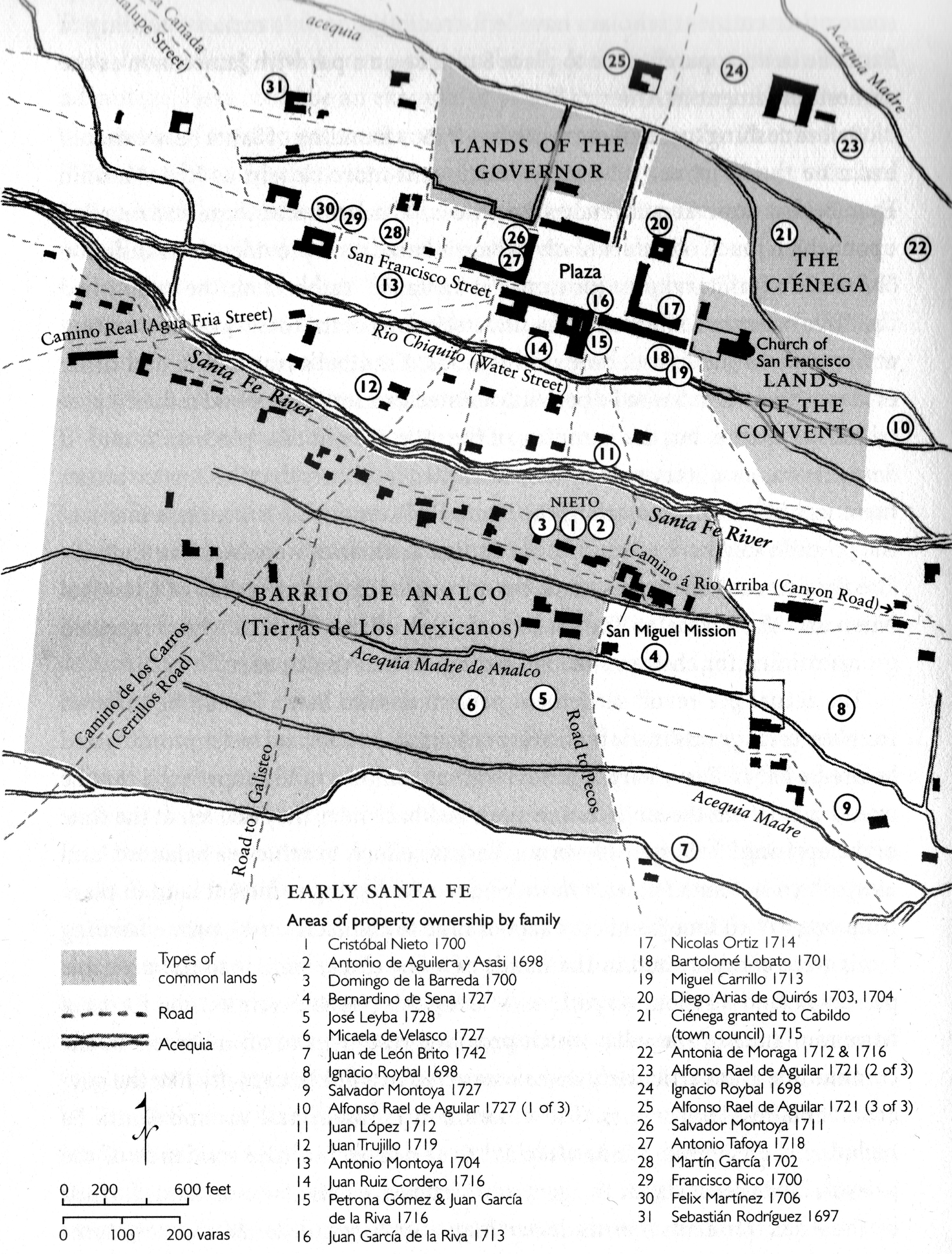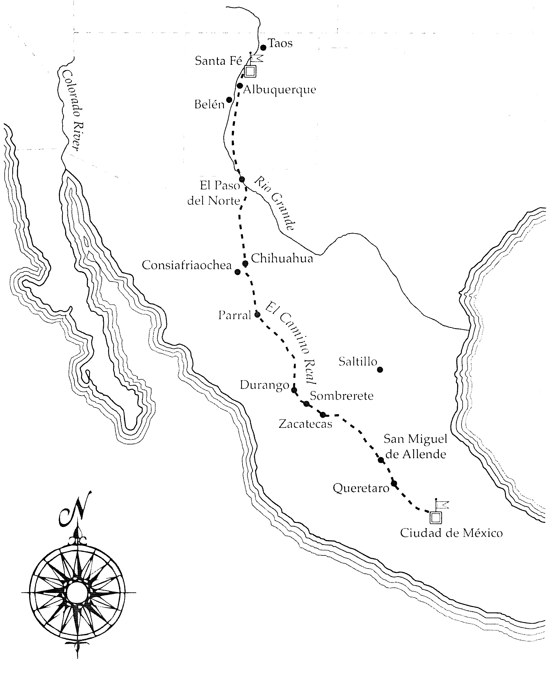
Most human beings love maps, or at last this human being does. It allows us to do the one thing that we cannot yet do, that is, fly and hover over an expansive area all by ourselves. Map for directions (Aztec maps with footprints), for delineating boundaries (surveyor maps), and for notions of human occupations (aerials), and just because. The few maps below are those used and collected by me as a land use planner and consultant and as a historian. Some are found elsewhere and are included because of their color and design. Several are maps that I and other people prepared with grants from the New Mexico State Historic Preservation Office. Some are maps from the two Spanish Colonial books found elsewhere. I have shown the title, date, source, and other information in the caption.

Most human beings love maps, or at last this human being does. It allows us to do the one thing that we cannot yet do, that is, fly and hover over an expansive area all by ourselves. Map for directions (Aztec maps with footprints), for delineating boundaries (surveyor maps), and for notions of human occupations (aerials), and just because. The few maps below are those used and collected by me as a land use planner and consultant and as a historian. Some are found elsewhere and are included because of their color and design. Several are maps that I and other people prepared with grants from the New Mexico State Historic Preservation Office. Some are maps from the two Spanish Colonial books found elsewhere. I have shown the title, date, source, and other information in the caption.